We recently released Ogma 2.8, a new version of Ogma, our JavaScript graph visualization library. This version comes with a new Geo engine that:
- Improves the library performance when visualizing geographic networks.
- Facilitates integration with GIS tools and data formats.
- Adds support for advanced geospatial visualization features such as VectorTiles and Custom projections.
Ogma 2.8.0 brings a brand new Geo engine for Ogma built on top of leaflet.js – the de-facto standard library for geographical visualization. The leaflet.js library is very popular for web maps and supports tens of plugins and formats.
This means that with the new geo engine Ogma:
- Can be integrated seamlessly with most GIS solutions.
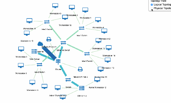
- Supports annotation layers, such as GeoJSON shapes, that can be combined with the Ogma event model.
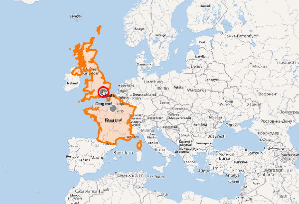
Ogma Geo mode can now be integrated with the map services of ESRI. ESRI/ArcGIS solutions are very popular in the GIS world, both as basemaps, and as full GIS platform to be used within applications.
Ogma also supports Vector tiles (used by Mapbox and ESRI for example) saving up network bandwidth and providing rich styling and modern, WebGL-based map rendering
It is possible to overlay the network data on top of an image such as a blueprint or a floor plan using the Geo mode.
The export feature in Ogma has been improved specifically for the new Geo mode: it is now possible to display basemaps but also additional layers, like annotations within the exported picture.
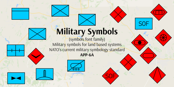
Annotations such as shapes or markers are fundamental to increase the context information in a visualization. For example, you can integrate in your map military symbols to make them more expressive and easier to read by military personnel.
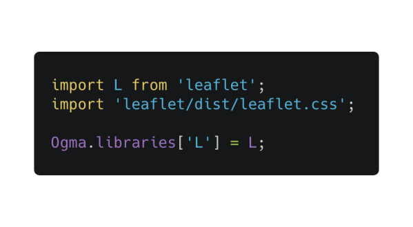
Have you used Ogma’s Geo mode before Ogma 2.8.0? Migrating to the new version of the Geo mode will only require 3 lines of code.
In fact the new Geo mode has been specifically developed to be 100% backward compatible. Just include the leaflet dependency in the application code:
The Ogma documentation has been updated with examples of the new Geo mode including:
- Geographical mode
- Dynamic geo base maps
- US Airlines
- PNG with geographical map
- Indoor maps
- Vector layers and GeoJSON
- Esri/ArcGIS basemap
- Vector tiles
Do you want to try this new version? Contact us to learn more.
A spotlight on graph technology directly in your inbox.